Lucky Hills Trails

Take the Scenic Route

Walking routes across the Lucky Hills regions — summit climbs, gully descents and half-day circuits. Filter by difficulty or region.

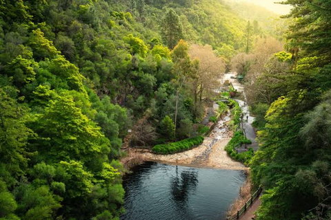
A walking path and stream winding through a green, wooded valley
Adelaide Hills, SA

Mount Lofty Summit Walk

The steady climb from Waterfall Gully to the summit is the best-known walk in the Adelaide Hills — a continuous ascent on a formed track, with a cafe and lookout at the top.

Moderate Approx. durationAbout 2–3 hours return Approx. distanceApprox. 7 km return
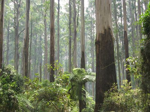
Straight, pale trunks of tall forest reaching out of frame
Dandenong Ranges, VIC

1000 Steps / Kokoda Track Memorial Walk

A short but genuinely steep climb through fern gullies and mountain ash, with memorial plaques along the way. Popular, so early starts are quieter.

Moderate Approx. durationAbout 1–2 hours return Approx. distanceApprox. 3 km loop
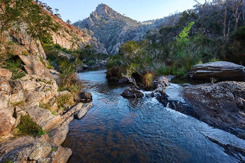
A rocky river gorge with a mountain peak rising ahead
Central Victoria

Werribee Gorge Circuit

A rugged circuit above and beside the Werribee River, including rock scrambling and exposed sections. Best attempted in cooler months by walkers with some experience.

Hard Approx. durationAbout 4–5 hours Approx. distanceApprox. 10 km circuit
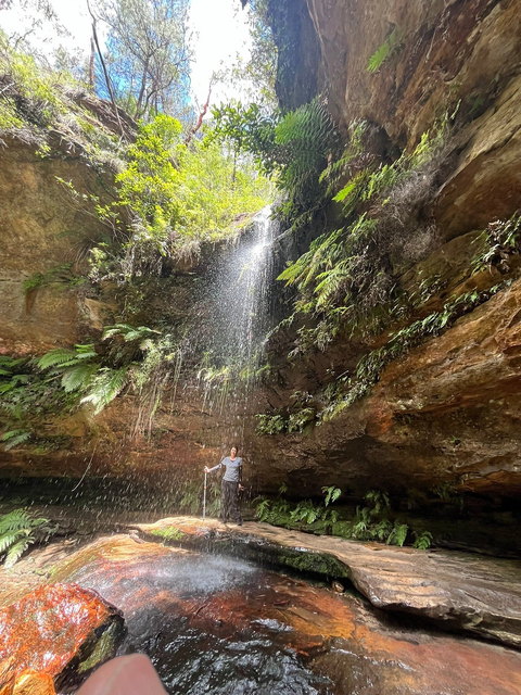
A walker behind a thin waterfall in a fern-lined sandstone gully
Blackheath, NSW

Blue Mountains Grand Canyon Walk

A descent into a cool, fern-filled canyon and back out to the escarpment. Stone steps, overhangs and creek crossings throughout.

Moderate Approx. durationAbout 3–4 hours Approx. distanceApprox. 6 km loop
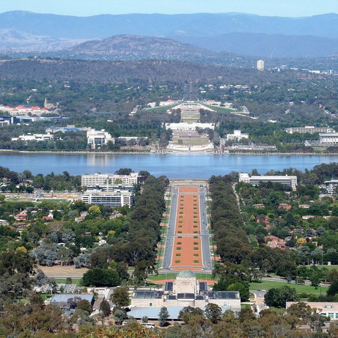
A ceremonial boulevard leading from a domed memorial across a lake toward parliament buildings
Canberra, ACT

Mount Ainslie Summit Trail

A well-used track from behind the Australian War Memorial up to the Mount Ainslie lookout. Steady rather than steep, with views opening out on the way.

Easy–Moderate Approx. durationAbout 1–1.5 hours return Approx. distanceApprox. 4 km return

Conditions can change. Check current local weather, access and park information before travelling. Distances and times are approximate.

Hiking Guides

Planning a walk in Australian hill country

General guidance only. For any specific track, the park or land manager publishing that track is the authority — not us.

Before you go

Check the official source

Track status, closures, fire danger ratings, park opening hours and any permit requirements come from the relevant national park service, council or land manager. Check on the day, not the week before — conditions change quickly.

Grading

Read the grade, not the distance

Australian walks are commonly graded on a scale that accounts for steepness, surface and navigation, not just length. A short walk can be a hard one. Where a track has an official grade, use that rather than our approximate description.

What to carry

Water, sun cover, layers

More water than you think, sun protection, warm layers for exposed ridgelines, sturdy footwear and a charged phone with an offline map. Tell someone where you are going and when you expect to be back.

Timing

Start earlier than planned

Hill car parks fill early on weekends, afternoons are hotter, and light goes quickly in gullies and on east-facing slopes. An early start solves several problems at once.

Etiquette

Stay on the track

Formed tracks exist to protect both walkers and the vegetation either side of them. Take rubbish out, give way going uphill, and leave gates as you found them on farmland routes.

In an emergency

Know how to call for help

Emergency services in Australia are reached on 000. Many popular tracks carry numbered emergency markers — note them as you pass. Reception in gullies is often poor, so do not rely on it.